The Thanksgiving holiday is right around the corner and weather remains active across the country.
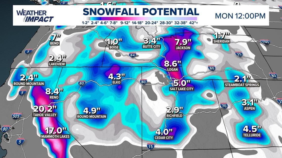
A lot of weather is happening across the country right now with Thanksgiving right around the corner. A large winter storm is dumping almost two feet of snow in the Sierra Nevada mountains while Florida is dealing with school closures due to historic flooding.
That same low pressure impacting Florida may become a tropical system this weekend before another Nor’easter barrels down on the East Coast next week. This active storm track is certainly a product of El Niño conditions, even partially.
West Coast winter storm
Accumulating snow and dangerous wind gusts will impact portions of Nevada through at least Friday. The Ruby Mountains, located in northeast Nevada, could see snow accumulations up to 18 inches with winds gusting near 40 mph. Most of central and northern Nevada is also under winter weather advisories due to snow totals ranging from 2 to 6 inches.
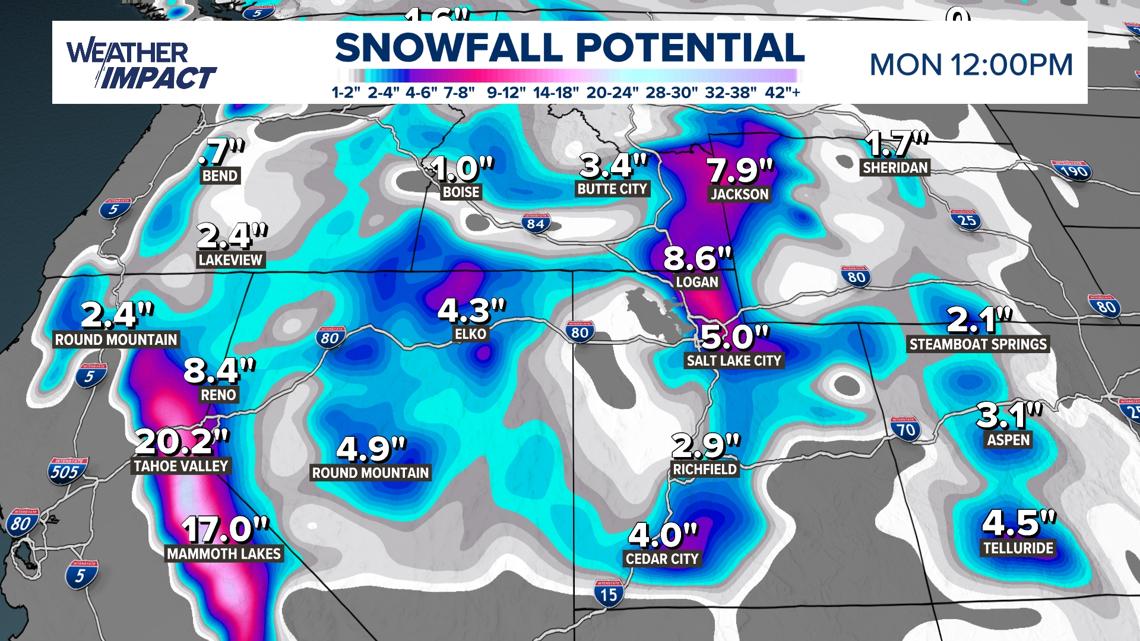
In the Sierra Nevada mountains, snowfall accumulations could peak near 20 inches below 7,000 ft, with ridgetop totals close to 30 inches. Lake Tahoe could even see around 10 inches near lake level with wave heights of 2 to 4 feet.
These same regions will also experience impacts from gusty winds. Lower elevations will see gusts near 45 mph, with 70 to 100 mph possible along ridgetops. This will make travel extremely dangerous, if not impossible.
Along the California coast, dangerous wave heights, high surf and coastal erosion remain a huge problem. Along the Bay Area, down to Monterey and up to Santa Rosa, residents are encouraged to stay away from jetties, piers and rocks due to the possibility of them being swept away. Breaking waves of 15 to 18 feet are likely, with higher waves offshore.
Flash and coastal flooding also remain an issue in southwest California as well, including Los Angeles and Santa Barbara. Water is expected to cause damage to piers, lead to dangerous swimming conditions, and a high rip current risk.
These conditions could worsen with another storm on the way next week.
Florida flooding
Flash flooding in Florida has led some school systems, like Miami-Dade, Broward, Brevard and Volusia, to close schools this week. Many of these areas have already seen 3 to 6 inches fall with a lot more on the way.
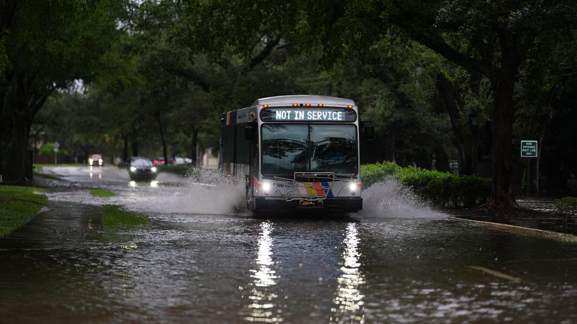
Near Cape Canaveral, forecasts call for an additional 4 to 8 inches, with Daytona Beach, Melbourne, and Vero Beach in the bullseye, for another 3 to 6 inches. All of southeast Florida, from Homestead to West Palm, also remains under flood watches due to heavy bands of 3 to 5 inches likely.
This large low-pressure system will eventually move up the Florida coast, bringing heavier rain to Jacksonville and Brunswick, Georgia, through the weekend. It may even move offshore, over the Gulf stream, where it could develop tropical characteristics.
Tropical development
Low pressure near Florida eventually shifts northward, impacting Georgia and the Carolinas this weekend, especially near the coast. Heavy rain bands will approach Georgia by Saturday afternoon, with impacts to the Carolinas more likely on Sunday.
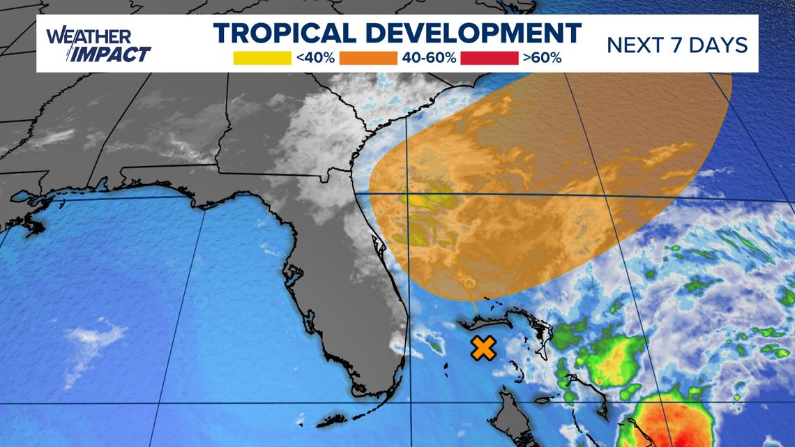
There is still uncertainty with the forecast because meteorologists will want to watch how the low pressure acts and where it moves over the next day or two. However, residents along the coast should prepare for beach erosion, coastal flooding, gusty winds, and dangerous rip currents through at least early next week. If you live inland, prepare for a potentially rainy end to the weekend.
By Monday, low pressure is impacting the rest of the East Coast and New England states with rain and wind, but exactly where is still to be determined. Travel may be hazardous at times but not as impactful as the West Coast. Snow doesn’t look to be a factor in this first storm of next week, but a brewing Nor’easter could arrive just before Thanksgiving.
Potential Nor’easter
Next week, we’ll be watching for another, larger storm system to impact the East Coast. This time, it could be a true Nor’easter with colder air coming from the northeast.
While it’s too far to know exactly who sees the most impacts, or even what they are, this signal is a bit stronger for heavy rain, accumulating snow, and dangerous winds. This would be especially midweek through the end of next week, including Nov. 25 through Nov. 27.
If you or your loved ones are traveling for the Thanksgiving holiday, please try to be where you plan to stay by Tuesday night or early Wednesday.
Stay up to date with changing conditions with your local, trusted meteorologists.