Duncan Kent and Dagnall Clutterbuck test the latest marine navigation app options for tablets and smart phones to find out what works best, and which features matter most
Using a navigation app on your tablet or phone to supplement or replace a fully featured chartplotter is a hardy perennial.
But by now, the benefits of electronic navigation for the leisure sailor are now indisputable (though we’d always recommend users have paper charts available and their eyes on the sea rather than a screen!).
We took a selection of the latest marine navigation apps designed for Android and Apple tablets and phones to see how they performed.
We examined:
- How well the charts were presented
- How easy it was to create waypoints and set up routes
- How they presented weather forecasts and tides and currents
- How they displayed AIS targets.
We also examined how the navigation apps tackled auto-routing and how routes could be made to interact with a vessel’s autopilot, where available.
What data does your navigation app use?
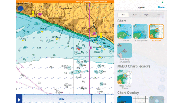
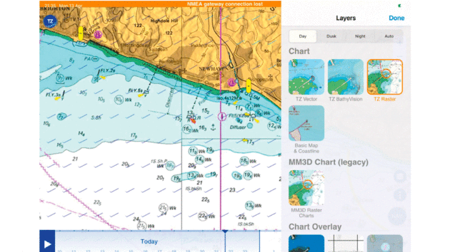
TZiBoat is one of the few nav apps tested that has access to both raster and vector charts. Photo by Duncan Kent and Dagnall Clutterbuck
The navigation apps we tested all use UK Hydrographic Office (UKHO) derived data. Most are now vector charts, giving the benefit of scalability and seamless panning, but often at the cost of clutter or loss of detail.
A few navigation apps use the more familiar raster charts, where a professional has determined what details to include based on the chart scale.
Extra features are often available to provide additional information – sonar charting being probably the most common, which adds extra depth information to the official charts. This is usually based on data from leisure sailors sharing their depth readings.
Relief is another common app term and adds a vividly coloured overlay displaying variation in depth.
Satellite images are another useful resource, which can offer extra detail that the charts may lack.
All these extras, however, should be used with caution. Although they can be very helpful when planning a passage to an unknown location, they may also be out of date.
Likewise, if you use any ‘auto-route’ planning features, you should always review the route carefully afterwards to check that it does not take you into a danger area.
Possible navigation app functions
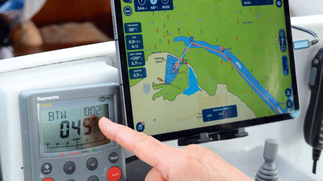
The majority of the apps had autotracking. Photo by Duncan Kent and Dagnall Clutterbuck
Route Planning
Planning a journey before setting sail is a skill we all use regularly. It requires us to generally know the length of the passage and the weather/tides.
Getting the passage length is now mostly an easy ‘point and click’ process, which will give a route that should avoid land but may take you into dangerous water. Used with caution, and at an average boat speed, this offers a good starting point.
The next step is knowing what the tide is doing and what currents are expected.
Weather and tides
Most navigation apps show the tides and weather and allow you to make informed personal judgements about when it would be best to travel.
A very few navigation apps will even take the tidal currents and wind into their calculations to find the best time to leave or arrive, along with a predicted passage time.
When it comes to weather, almost all the apps now have some method to receive and display internet weather.
Getting the forecast is an invisible background action in most navigation apps, but a few still require manual actions to download the relevant GRIB files.
These are large files that can contain a considerable amount of weather and current data.
While some apps use predicted tidal currents, others rely on GRIB files for their predictions.
These are really only ideal for offshore currents and may provide less visibility of details typically seen in the chart tidal diamonds.
Interactivity
All modern tablets and phones now allow wifi connection to the internet.
On a boat, you can also install a wifi router to connect to your boat instruments. Most of the navigation apps we tested allow connection to the boat router to display instrument data.
However, when a tablet or phone is connected to wifi, it usually assumes this is ‘the way’ it must get the internet, so when connected to a boat router, the app can appear to have no internet connection.
This could mean you will not be able to see or download any online data such as the weather.
All is not lost, though, because most phones can be switched to use cellular data, even when connected to the boat’s wifi router. Some routers even make this process seamless (particularly Apple devices).
Why integrate internet in your navigation app?
One reason why you may wish to have internet access is to use ‘Over the Horizon’ (OTH) AIS.
This allows some navigation apps to access online global AIS networks and overlay the AIS targets on the charts.
For those that do not have inbuilt OTH AIS, some can import data from the Boat Beacon app if it has the AIS sharing subscription.
If you do not have an onboard AIS receiver, OTH AIS can be helpful but should not be relied on.
If you have multiple phones/tablets on board all sharing the same instrument data, then you’ll need to use User Datagram Protocol (UDP) to connect. This effectively broadcasts the data so multiple devices can view it.
If you want to connect to the boat’s autopilot, however, you’ll need to use Transmission Control Protocol (TCP) to enable the app to send messages back to the router and onwards to the autopilot. Only one device at a time will be able to use this link.
How we tested each navigation app
The navigation apps were tested on our iPads, although most are also available for Android tablets and phones.
We spent some time setting up and becoming accustomed to each app’s operating logic and set up a few routes before going out on the water.
To compare chart detail, we studied a small local inlet in Chichester Harbour, Oar Rythe, to see how well it was displayed.
Popular with seal watching trips, this exercise showed interesting differences in the various charts and the visibility of some smaller shallow features that are of interest.
For instance, in the Navionics charts, Oar Rythe is clearly shown but not named at this scale. It even shows a possible anchoring spot, when it clearly dries on the other charts!
The same vector image on TZiboat (and most other apps) omits the apparent anchoring spot and loses all the detail of this well-used inlet.
Whereas TZiBoat’s raster version of the same chart uses the familiar UKHO imagery, so the location and rough outline of the Rythe are visible once again.
Adding in a satellite view often shows the real situation.
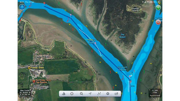
Satellite views give real-life visual context while navigating, helping you to see the shallows and avoid hazards. Photo by Duncan Kent and Dagnall Clutterbuck
We also rated the charts, weather and route plotting features of each navigation app to assist us in deciding how each performed with every function.
On the boat was an AIS transponder and a Vela-Navega NMEA3WIFI wifi gateway, which we tested earlier in the year.
This allowed us to view the AIS and instrument data from the Raymarine SeaTalk1 instruments on the apps that could act as repeaters, and to send waypoints and GoTo data to the Raymarine autopilot, where the app allowed.
AngelNav
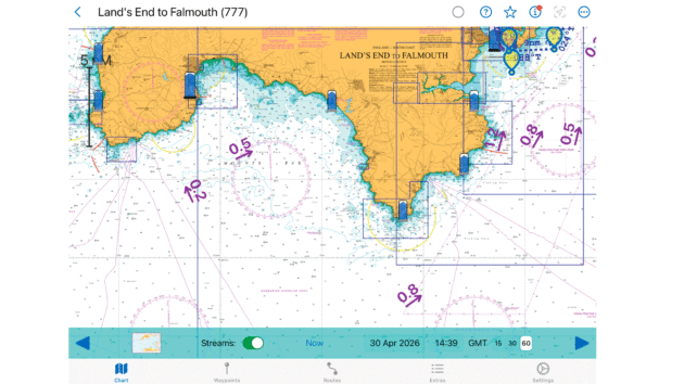
AngelNav uses only raster charts. Photo by Duncan Kent and Dagnall Clutterbuck
Currently only available for Apple products, AngelNav was created for sailors wanting to use modern navigation tools, while retaining the ability to fall back on traditional navigation techniques when necessary.
Working with a variety of raster (only) charts that aren’t cheap and can no longer be used after the subscription expires, its primary raison d’etre is that it allows manual estimated positions (EPs) and tidal triangles to be plotted on the screen, although we had difficulty extending the calculation to consecutive tidal vectors on longer routes.
Plotting a route manually (it has no auto-routing) is simple, as is editing waypoint (WP) positions, but just as with the paper versions you have to select each chart separately as there’s no automatic panning to an adjacent one.
The route overlay remains, however, regardless of the chart being viewed and it can be set to auto-change charts on passage.
Plotting a simple GoTo is also easy, though, with a double-tap of the screen bringing up a menu allowing waypoints to be edited en route.
Satellite views are also available as an add-on and easily selected.
The tidal stream chart overlay is somewhat rudimentary, although it’s possible to access more detailed tide tables. We did, however, miss the inbuilt weather forecasting found on other navigation apps.
While it does offer NMEA connection, it’s only for incoming instrument and AIS data, not for autopilot control.
Charts: UKHO £24.99pa per area (6 UK areas), Imray £69.99pa per area.
Options: AIS £4.99, Sat view £4.99, Geo files £4.99, Instruments £4.99; Tides £6.99.
AquaMap
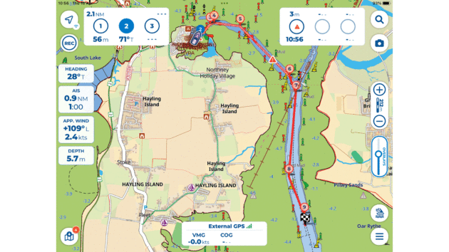
Auto-routing can be easily edited. Photo by Duncan Kent and Dagnall Clutterbuck
This app has a clean, intuitive interface and the charts are clear.
The annual subscriptions are very reasonably priced but, as with most navigation apps, you must remember to download the charts to use them offline.
These can be trialled for 14 days free of charge, but you must sign up first and then remember to cancel if you no longer want them.
Setting our Chichester to Bembridge route was a simple exercise and used intuitive screen pressing.
Auto-routing works well, provided your boat settings are entered correctly, and ‘route explorer’ is worth having to double-check the proposed route is safe.
For further safety, an auto-route is coloured differently from a manually plotted one.
The auto-routing, though, does not include tides, wind or polars in its calculations and it added a waypoint and a small course change for no obvious reason, but at least you can edit the route easily if required.
Current weather forecasts download easily enough and are detailed, although they are limited to 40 hours ahead and the tidal current forecasts seem to be available only for one day.
An option we did like was the chart/satellite view slider control that gently merges one view over the other.
Charts: UK Channel + Northern France £13.49, UK & Ireland £19.99pa.
Options: Advanced package (£14.95pa) includes weather, satellite view, route explorer, AIS overlay and anchor alarm.
SeaNav
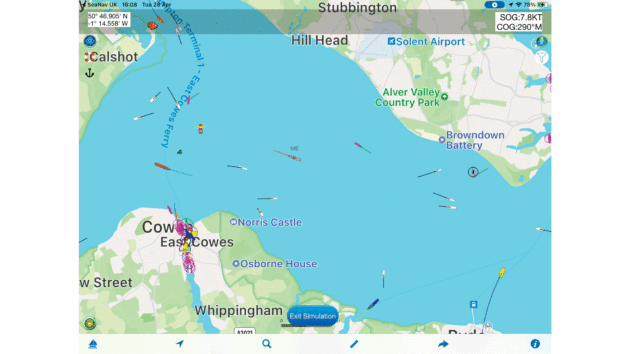
Multiple chart-layer options help keep the screen less cluttered. Photo by Duncan Kent and Dagnall Clutterbuck
This navigation app uses vector charts based on official UKHO data.
As well as displaying the chart and AIS targets, either from the boat’s own router or the internet, the app offers some unique ‘Pro’ features (at extra cost) including augmented reality (AR) and autopilot control via an Apple Watch if you have one.
Chart manipulation can be a little slow on older tablets and phones but is much faster on more recent devices.
Tidal stream diamonds show on the chart and can be clicked to bring up more data and there are multiple chart-layer options for user preference and to help declutter the screen.
It’s also possible to blend the satellite image into the chart when investigating drying channels.
A long press on the screen calls up a weather forecast option in a sub-window, which gives an excellent Windy forecast with currents and wave data.
It was easy to use auto-route for our test passage from Chichester to Yarmouth.
By simply touching the boat icon, the app provided a bearing and distance to the start of the route and sent them to the autopilot.
While it provides an estimated time of arrival once you are on passage, it doesn’t take into account any tidal currents.
In comparison with other auto-routing apps, SeaNav produced a relatively simple route with clear waypoints that could be easily edited.
There are unique features when used on an iPhone – once underway a connected Apple Watch can display instrument data, AIS and some autopilot controls.
And an augmented reality (AR) feature allows you to hold the phone up to the horizon and see superimposed images of AIS targets and buoys to help identify them.
Altogether, the SeaNav app offers a somewhat different take on navigation apps.
Charts: UK & Ireland £24.99/yr.
Options: Pro features £14.99, Live Ships £18.99pa, Weather £7.49, Anchor Watch and MOB £5.99.
Savvy Navvy
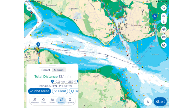
Route planning can be auto or manual. Photo by Duncan Kent and Dagnall Clutterbuck
The second most expensive app subscription trialled, we used the ‘Elite’ level for our assessments.
What sets this navigation app apart is the route planning, which can be automatic or manual.
It’s very simple to create a route or GoTo, with auto-routing that includes calculations for the effects of the (GRIB-based) currents and wind and thereby enables reasonably accurate scheduling.
Routes can also be stored in the logbook and shared with others via social media.
Tidal curve and current spot data are available with a simple tap on the feature window and chart, as is the latest local weather data.
AIS targets can either be overlaid from the boat’s instrumentation via the NMEA connection or via the internet when available.
Information on anchorages and harbours is provided, including user reviews, and it’s even possible to overlay a 3-point fix onto the chart.
Tested on a simple West Pole to Yarmouth route and auto-routed around Cowes, it calculated the journey could take 4h 4m if we left at 2140, or 6hr 16m if we postponed our departure until 0040.
If sailboat mode is selected it will use predicted wind and polar data, so it would include tacks into the wind in its calculations, and motoring if the wind dies.
Weather forecasts, boat instruments and AIS targets can all be displayed, but the program cannot yet send commands to an autopilot.
If you’re not concerned with that, this app does everything – albeit at a price.
Charts: Essential package £59pa for charts and routing.
Options: Explore package £95pa for offline charts, tidal heights, weather and GPX file import/export. Elite package £99pa adds tidal streams, ECWMF weather forecasting, satellite mode, anchor alarm, NMEA Connect to Garmin and Raymarine chart plotters and OTH AIS.
TZiBoat
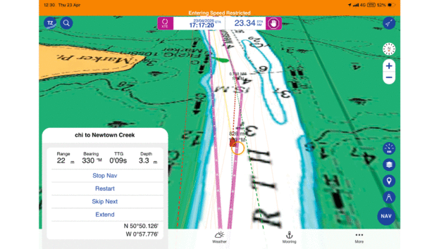
TZiBoat becomes easier with use. Photo by Duncan Kent and Dagnall Clutterbuck
This app is part of the TimeZero family of navigation software and offers a plethora of useful and affordable navigation features.
For a yearly subscription you get both vector and UKHO-based raster charts of the UK and both vessel AIS and OHT AIS are available at reasonable prices.
This is a comprehensive navigation app with numerous features, although it can take a while to discover how to access or display them to your liking.
We found it slightly puzzling initially, but once we’d mastered the best configuration for us it was easy to use and offered all the navigation data you could possibly want.
Touching the screen allows you to place marks easily, and once placed they can be used as a GoTo target or as part of a route. Assisted (auto) routing is also simple to use.
Stored but inactive routes can be made to appear on the chart as small blue arrows pointing towards their destination. Touching the arrow opens the route and a dotted course line appears.
A clear instrument panel then displays Course to Steer (CTS) to the next waypoint, along with a wide, customisable selection of instrument readings and tidal curve data.
Somewhat intrusive when open, the panel is easily toggled on/off by a screen icon.
Tidal current arrows on the charts can also be clicked to open a graphic display and a meteogram (timeline of weather data) can be opened at the bottom of the screen, showing Global Forecast System (GFS) internet weather data.
More detailed and animated forecasts are also available with a premium weather subscription.
Other features include optional hi-res bathymetry, log, underwater relief shading and automatic optimum anchor spot calculation using wind, depth and topology.
This is also the only app tested that can display radar data when connected to a Furuno wireless radar unit.
Charts: UK chart £39.99pa.
Options: Premium Weather £8.99/month, AIS and NMEA module £24.99pa, Radar Module £49.99 (one off).
Navionics Boating
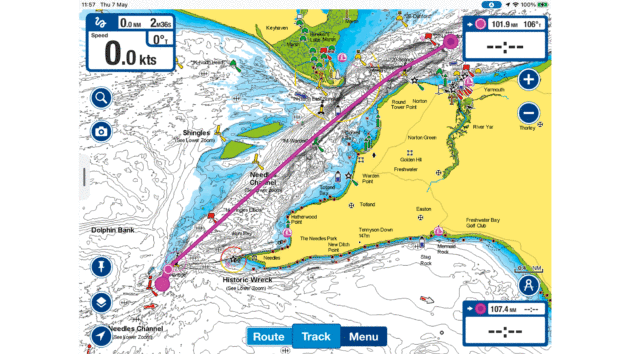
Navionics uses SonarCharts which have greater depth detail. Photo by Duncan Kent and Dagnall Clutterbuck
Possibly the most well-known navigation app, Navionics Boating is now owned by the large US marine electronics company, Garmin, which has made several changes, a couple of which have proven unpopular with existing users.
The first was the removal of the PC planning feature that allowed you to create routes on your PC and download them to the app.
The second is making the charts unusable after the subscription has expired. However, you can share routes via the Active Captain app and to any modern Garmin chartplotter.
It has limited NMEA connectivity but does show depth and can import AIS data from the boat’s instrument network or from Boat Beacon for OTH AIS.
The app subscription can be downloaded onto five different devices, although simultaneous connections are limited to two devices only.
Though renowned for its crowd-sourced bathymetry (SonarCharts), based on many users sharing their depth data, the feature can be a mixed blessing.
Yes, its sonar charts have much greater depth detail and are arguably more up to date than other apps, but the bathymetry contours can actually update in real time if you set ‘SonarChart Live’ mode, which can be confusing if navigating a narrow channel.
The app also displays tidal diamond and tidal height data, along with a simple weather display, and the GoTo function and auto-route planning are easy to use. It cannot send commands to an autopilot.
Despite its simplicity, we found ourselves returning to this app frequently for its clear, detailed charts.
It was the only navigation app that showed Oar Rythe, near where we were testing, as navigable (seal viewing trip boats use it regularly).
Charts: UK & Ireland £39.99pa.
Options: All included.
iNavX
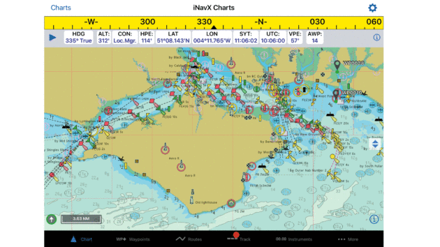
iNavX has no auto-routing function. Photo by Duncan Kent and Dagnall Clutterbuck
This navigation app has a fast interface and works well. We used Navionics-derived charts, but iNavX makes a point that you can use multiple chart sources.
It has a mostly intuitive use of the touchscreen, making it simple to use.
Connection to a wifi multiplexer is also simple, but annoyingly required resetting each time the app was booted up.
Routes need to be created from a series of predetermined waypoints, and it has no auto-routing facilities.
Although waypoints can be created directly on-screen, setting up routes is slightly less easy than with other apps.
However, it does mean that routes will go from a named waypoint to a named waypoint, which can be invaluable when you are on passage, especially when connected to an autopilot.
The screen can display instrument data when connected, and weather data in the form of GRIBs can be loaded via email, although this felt like a complex process compared to other apps.
For some reason the AIS Live (OTH AIS) option is very expensive.
Although still good with nice, clear charts and logical operation, we feel the app is beginning to show its age compared to more recent competitors.
Charts: iNavX Professional + Navionics UK & Ireland charts £39.99/yr, Imray raster charts £69.99/yr per chart package. Prices differ for phone or tablet.
Options: AyeTides £7.99, Theyr Premium weather £9.99/yr, AIS Live £90.99/yr.
QTVLM
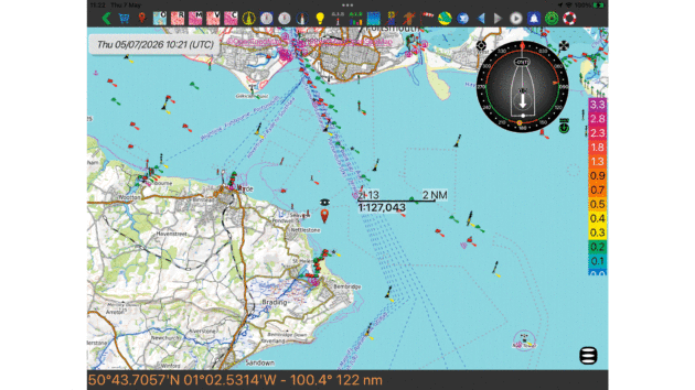
QTVLM can be used with UKHO raster charts as well as vector and NOAA charts. Photo by Duncan Kent and Dagnall Clutterbuck
One for the techies, this navigation app was originally developed for virtual yacht racing online in the ‘Virtual Loup de Mer’, but it can be very useful for all sailing yachts.
With extensive wifi connectivity options, including the ability to send routing commands to an autopilot, it can also download GRIB weather files, albeit a little ‘clunkily’.
We tried it with UKHO raster charts, but it can also use vector and NOAA charts.
Being primarily designed for yacht racing, route creation incorporates the effect of the wind (and GRIB-based current) along the proposed route, so it will provide an ‘optimal’ route that varies as the time or forecast wind changes.
It doesn’t use the chart-based current or tide predictions, though, relying instead on downloaded GRIB files for these.
Like other apps utilising polars, when auto-routing it will automatically provide tacks when going into the predicted wind.
We found the interface less intuitive after the other apps, but the displays are highly user-configurable should you wish to delve into the many available options.
Pricing appears somewhat confusing and depends on the chart package and weather options chosen.
Although it can use a wide range of charts, for the UK the Visit My Harbour (VMH) UKHO raster charts are the least expensive if only using one device.
App: IOS/Android unlock £49.99, Windows FOC.
Charts: VMH UK & Ireland raster £29.95pa per device.
Options: Unrestricted GRIB weather from Meltemus £59pa.
Summary
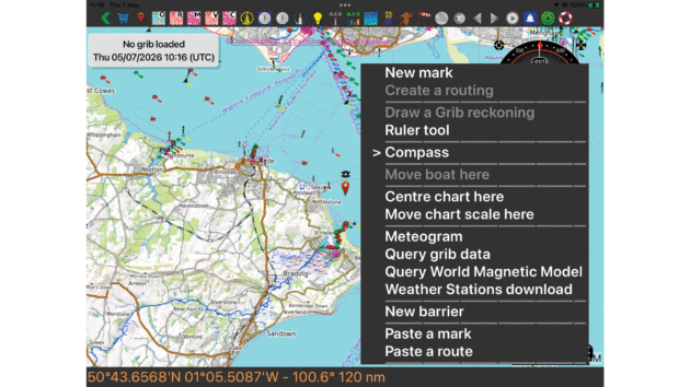
Spend time getting to know the menu and functions of your chosen nav app. Photo by Duncan Kent and Dagnall Clutterbuck
Familiarity and practice
Nothing beats practice with your chosen navigation app.
Some felt hard to use because we expected a process that worked with one app to work with another, even subtle issues like requiring a double tap or a long screen tap, for instance.
However, many features that seemed complex at first become obvious when tried several more times.
Chart features visible on some apps can make the display seem cluttered but these are often easily switched off in the user menus.
Trying the apps within their free test periods is the best way to decide if the app suits your style of sailing.
One click routing
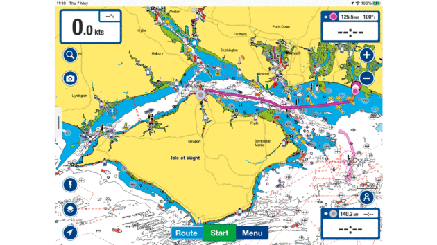
Auto-routing is a useful function but always check the proposed route. Photo by Duncan Kent and Dagnall Clutterbuck
We very much liked the ability to quickly get a simple route from ‘A to B’ that auto-routing provides.
Auto-routing should be used only with caution, however, as it may not be sensible in confined waters, and some navigation apps were better than others in pointing out possible dangers of the proposed routes.
Regardless of warnings (or not) we’d always recommend studying the proposed route in detail before setting off.
Some apps allow you to easily move pre-set waypoints, but the otherwise excellent Savvy Navvy proved frustrating here, insisting on recalculating the autoroute or adding an unwanted extra end point.
A suggested application for auto-routing has been to use it to alter plans mid-journey to avoid bad weather or for other reasons.
This is possibly a subject for a separate article, but most apps will allow you to immediately navigate to a click from your current position, and this can potentially be very useful.
Familiarity with the app is key here and practising before you depart will be invaluable.
Questions like: does it need a single tap, a long tap, a double tap, or tap and select from a menu, should come naturally in use.
Tides and streams
This is a non-obvious issue that became more apparent as we conducted comparison tests.
When route planning, we need to know the tidal effect and this usually includes the expected tidal streams along the route.
Admiralty charts provide these in tidal diamonds based on extensive survey data.
Our preference was for this tidal stream data to be visible on the chart and easily reviewed when planning. Only AngelNav would allow you to use these, and then only manually.
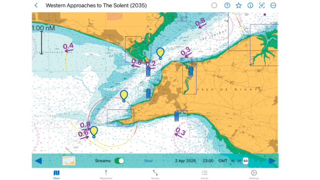
AngelNav was the only app tested that displayed tidal stream data on the chart for easy reviewing . Photo by Duncan Kent and Dagnall Clutterbuck
Savvy Navvy and some others use GRIB download forecast current data for the upcoming general current flows.
The resolution of these forecasts, however, is necessarily low. So, for example, in the Solent the GRIB shows the general currents around the Isle of Wight, but not the flow into and out of the harbours that can be seen in the tidal diamonds.
Close to shore current GRIBs should not be trusted, although they do allow some navigation apps (Savvy Navvy and QTVLM) to take account of these to provide a more accurate estimate of predicted passage timing, which is very helpful.
Auto-tracking
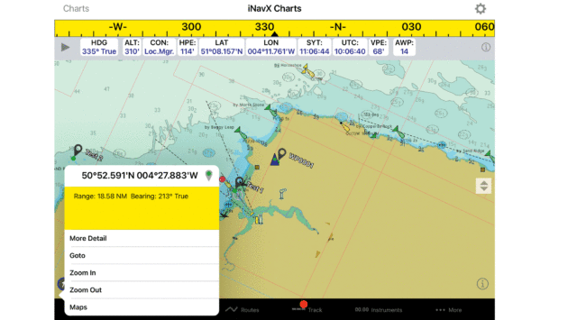
Out of the eight apps tested, five, including iNavX, could send GoTo command and XTE messages to the autopilot. Photo by Duncan Kent and Dagnall Clutterbuck
Of the navigation apps tested, only AquaMap, iNavX, qtVlm, SeaNav and TZiBoat could send a GoTo command and XTE messages to an autopilot, allowing it to automatically follow a route.
Much like full autonomy for cars, we both felt letting an app take full control of a vessel’s autopilot would, with the current level of technical development, be somewhat foolhardy.
During our trials in the confines of a harbour, none of these apps inspired sufficient confidence in us to leave the helm unattended.
In fact, at best their course-keeping was akin to a drunken sailor, unless the autopilot settings were drastically altered, although this could be partially attributed to an old autopilot that might not have been optimally set up.
Either way, we believe most people will prefer keeping the autopilot operation separate and manually setting the course rather than allowing the tablet or plotter to take full control.
Subscriptions
While all the navigation apps we tested were free to download, it’s worth noting that any free trial of the charts often requires you to sign up and provide payment details.
So, if you only want to check them out, do remember to cancel the subscription before the free trial period ends.
Some apps need a one-off (non-refundable) unlock for some features, so bear this in mind too.
Most subscriptions will allow you to install the app on more than one device but do check with the supplier.
There may also be limits on how many devices can run the navigation app simultaneously as well as the number of connections the wifi router can support.
Some of the apps will automatically renew your subscription at the end of the period unless you specifically ask it not to.
More importantly, many of them will not let you use extra features or view the outdated charts unless you renew your annual subscription.
For safety, most do not disable the viewing of previously downloaded charts when the subscription runs out.
E-Nav report
Recently, the Royal Institute of Navigation (RIN) published its view on electronic navigation systems
and this report – available free as a digital download – includes a lot of excellent advice.
We’ve avoided duplicating topics covered by this document, so if you are interested in the debate over vector versus raster chart formats, reasons for electronic nav aid inaccuracy and a mound of other useful information on the subject, we recommend you read this excellent document.
What is the future of the navigation app?
It’s important to note that these apps, like most, are undergoing continual development.
When tested to their limits, we discovered more than a few bugs and over-complex methods for accessing a feature.
Where we considered them dangerous, we duly informed the developer and in most cases they corrected and updated their code very soon after.
Key Definitions
- System:
- I = iOS
- A = Android;
- Win = Windows
- Mac = Apple Mac
- R/V: Raster and/or vector cartography
- AIS: AIS target overlay available
- OTH AIS: over the horizon AIS (online) *using Boat Beacon
- AP: Ability to send route/GoTo commands to autopilot
- Tides: tidal heights & currents
- Currents: tidal streams
- WX: In app weather display
- Anch: anchor alarm
- AR: automatic route calculation
- Sched: departure and/or arrival time schedules
- Polar: auto route for sailing using boat polar and wind
- GPX: GPX file import/export to chartplotters
- Sat: ability to switch to or download satellite imagery
- 3D: 3D chart orientation option
- Night: day and night-time lighting modes
- Relief: underwater relief shading
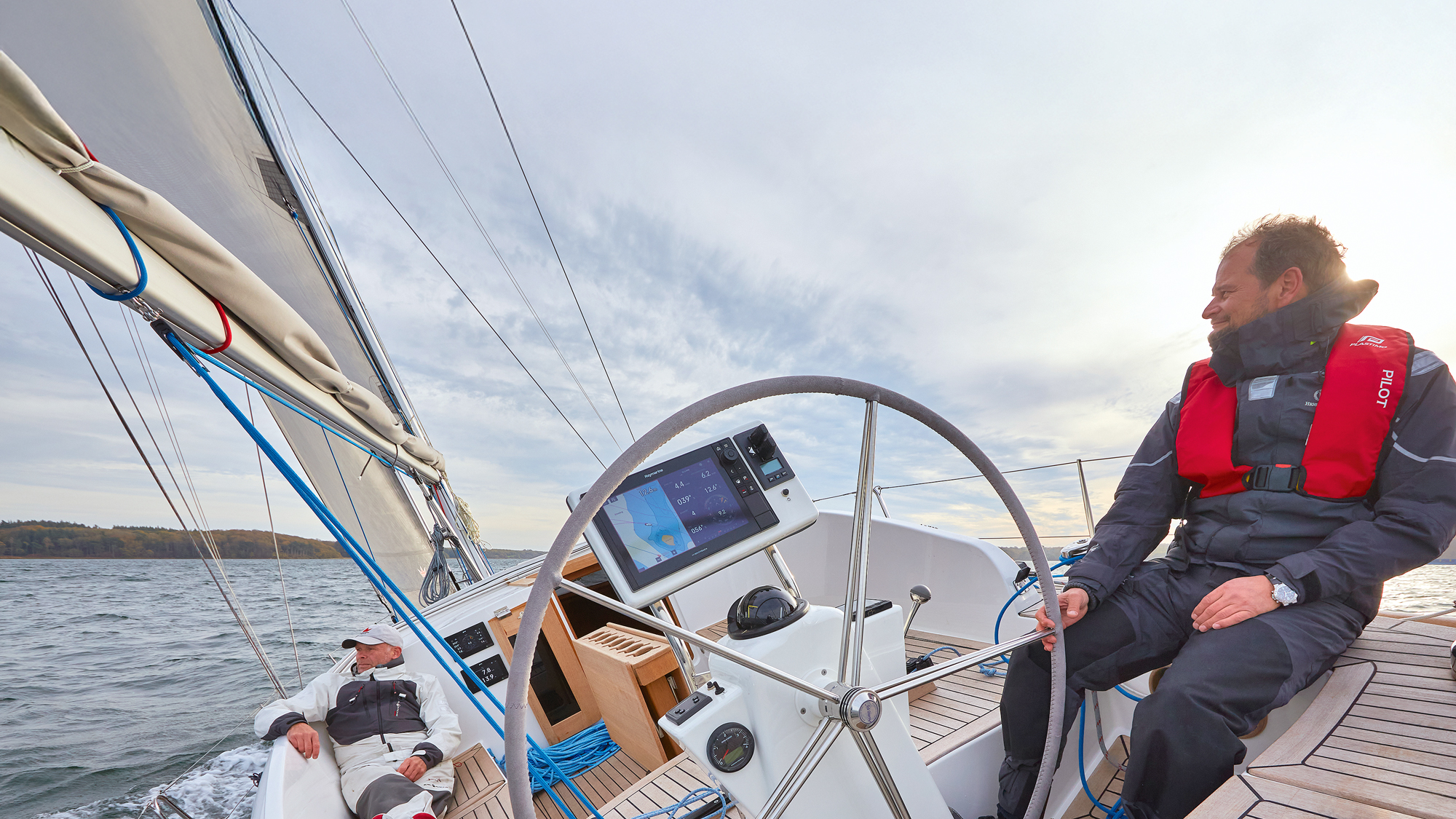
How often do you stop and really sit down with your chartplotter? Navigators are necessarily tunnel visioned once under way:…
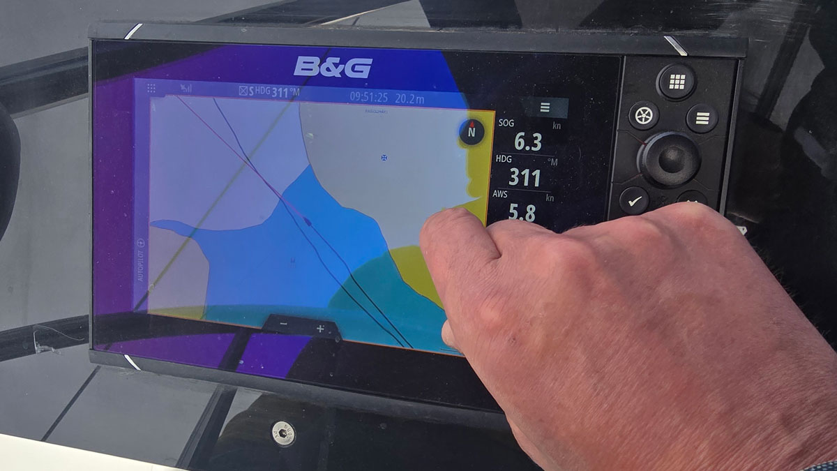
Whether you’re new to boating or looking to enhance your navigation with a phone, tablet or MFD, Ali Wood runs…

One of the best ways to choose new marine electronics is to get your hands on kit from a range…
Want to read more about your navigation app?
A subscription to Practical Boat Owner magazine costs around 40% less than the cover price.
Print and digital editions are available through Magazines Direct – where you can also find the latest deals.
PBO is packed with information to help you get the most from boat ownership – whether sail or power.
-
-
-
- Take your DIY skills to the next level with trusted advice on boat maintenance and repairs
- Impartial, in-depth gear reviews
- Practical cruising tips for making the most of your time afloat
-
-
Follow us on Facebook, Instagram, TikTok and Twitter
PBO web categories